

A week has passed since a fast-moving chain mudslide, triggered by a high-altitude glacier collapse in Nepal, struck Gyirong Port on the China-Nepal border in southwest China’s Xizang Autonomous Region on August 26, causing heavy casualties and leaving many people missing.
A number of media outlets have continued to follow the disaster closely. For the first part of today’s post, I have put together the latest information released by the Chinese side, including casualty figures, risks at the disaster site, how far Chinese rescue teams have reached, China-Nepal cooperation in the relief effort, and what Chinese experts say caused the disaster.
For the second part, I selected a report published by The Paper on August 29 about a disaster risk reduction and cryosphere conference held in Chengdu on the very day of the disaster. It brought together experts from China, Nepal, India, Pakistan and other Himalayan countries, and happened to provide a direct channel for experts on both sides to exchange information within hours of the disaster.
I found their discussion particularly useful because it addresses, from another angle, many of the questions raised since the disaster: why an event like this is so difficult to predict, the practical obstacles to building a cross-border disaster warning system, and the efforts China and Nepal have already begun to make toward more regular cooperation.
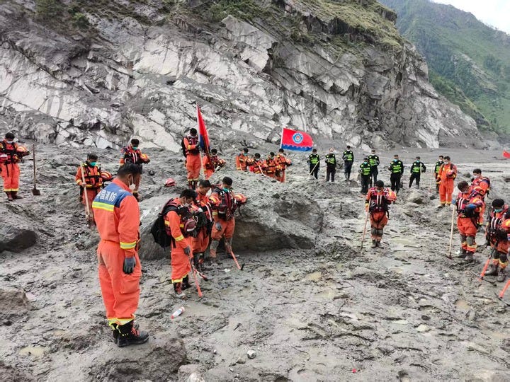
Rescuers observe a moment of silence for the victims of the Aug. 26 mudslide near the Gyirong Port in Gyirong County, southwest China’s Xizang Autonomous Region, Sept. 1, 2026. [Photo/Xinhua]
Part I: The latest on the disaster
Casualties on the Chinese side
According to a Xinhua report on Sept. 3, 21 people have been confirmed dead and 541 others remain missing after the mudslide struck the border port, the regional government said at its latest news briefing.
Rescuers have recovered 847 personal belongings from the disaster area. Local authorities have also received 876 phone calls from relatives of those killed or still missing and have been responding to their inquiries.
Casualties on the Nepalese side
The death toll from the devastating August 26 mudslide in Nepal has risen to 1,252, with another 4,875 people still missing as of 10 a.m. local time on September 3, according to a Xinhua report citing Nepalese police.
Road access
Road access to the zone was basically restored at 10 a.m. Wednesday after days of round-the-clock repair work on the G216. Over 10 pieces of heavy machinery have entered the core area to aid on-site rescuers.
China-Nepal cooperation
China’s Ministry of Water Resources said Wednesday that the ministry is now providing Nepal with daily updates on the development of a barrier lake above Gyirong Port, cascading risks associated with the Cuojian River impact crater in Nepal, glacial lake risks in the Gyirong Zangbo River basin, the development and risk forecasts of new barrier lakes, and emergency hydrological monitoring.
Chinese foreign ministry spokesperson Guo Jiakun told a regular press briefing that China is preparing a third batch of emergency relief supplies, including Bailey bridges, epidemic prevention materials and emergency communications equipment. China is ready to send a second group of DNA identification experts based on Nepal’s needs, he added.
What caused the disaster?
Xinhua has released a three-minute animation on Aug. 28 explaining how the Gyirong mudslide developed.
On September 1, Xinhua published a more detailed account of new research led by the Institute of Tibetan Plateau Research under the Chinese Academy of Sciences on how the Gyirong disaster developed.
The researchers reconstructed the full chain of events from the initial ice-rock collapse high in Nepal to the destructive mudslide that eventually struck Gyirong Port. Their analysis suggests that the disaster was not simply triggered by a short period of heavy rainfall. Instead, several longer-term factors — including sustained glacier movement, warmer spring and summer conditions, increased meltwater and possible degradation of high-altitude permafrost — may have gradually weakened the stability of the source area. The researchers stress, however, that there is not yet enough evidence to identify a single direct trigger.
One of the study’s key findings is that the scale of the disaster was determined not only by the initial collapse. As the debris traveled through roughly 22 kilometers of valley, it continuously eroded the channel and picked up additional material from the riverbed and slopes. This process greatly increased the volume and destructive force of the flow before it reached Gyirong Port.
Researchers also detected several unusual seismic signals in the hours before the main collapse, some of which appear to coincide with smaller ice and snow movements. They say these signals may offer clues for future monitoring, though more evidence is needed before they can be treated as reliable warning signs.
The full analysis goes into considerably more geological detail than I want to reproduce here. Readers interested in the technical explanation can read Xinhua’s Sept. 1 report and use an AI translation tool if needed. The research was published the same day in the academic journal Science Bulletin. [Photo/Xinhua]
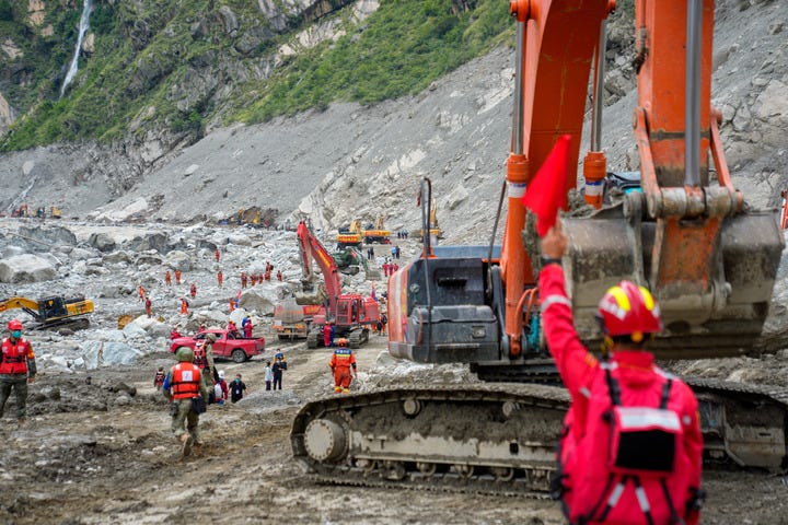
Rescuers conduct search and rescue operations at the core affected zone of the mudslide-hit Gyirong Port in southwest China’s Xizang Autonomous Region, Sept. 2, 2026. [Photo/Xinhua]
Part II: Why was this disaster so difficult to predict?
That is the latest information on the disaster itself.
But many readers are also interested in two related questions: why was an event of this scale not detected and warned of earlier, and what kind of cross-border warning cooperation currently exists between China and Nepal?
A report published by The Paper on Aug. 29 provides quite a few useful details. It focuses on a meeting that was already underway in Chengdu on Aug. 26, the day the disaster struck.
A meeting of Himalayan disaster experts was already underway
The annual meeting on disaster risk reduction and the cryosphere, organized by the International Center for Integrated Mountain Development, or ICIMOD, was being held on Aug. 26 at the Institute of Mountain Hazards and Environment under the Chinese Academy of Sciences and the Ministry of Water Resources in Chengdu.
Zhang Qianggong, head of climate and environmental risk at ICIMOD, said the meeting happened to bring together experts in cryosphere research, geology and disaster reduction from China, Nepal, India, Pakistan and other Himalayan countries.
After the disaster, the participants quickly pooled the information available to them and concluded that the mudslide had been triggered by an ice-rock collapse.
Could China and Nepal build a regular coordination mechanism?
“This kind of timely exchange of information and interaction is not yet routine,” Zhang said.
One of the subjects being discussed at the meeting was precisely whether China, Nepal and other Himalayan countries could create a cross-border disaster information-sharing platform and establish a regular coordination mechanism.
“We hadn’t even finished discussing it when the disaster happened,” Zhang said.
For now, exchanges among research institutions can be seen as an early step toward cross-border warning and coordinated disaster management.
But moving from scientific cooperation to an institutional mechanism would require interaction between governments and go well beyond research cooperation alone.
What Nepalese officials said about the current warning system
When the disaster happened on August 26, researchers from China and Nepal who had long worked on geological hazards were gathered in Chengdu.
Among them was Pradip Kumar Koirala, joint secretary at Nepal’s Ministry of Home Affairs and coordinator at the National Disaster Risk Reduction and Management Authority, or NDRRMA.
“I think neither side received any warning information,” Koirala said at the meeting.
People could see the water level rising and some realized something was wrong, he said, but the hydrological sensors did not respond effectively.
Smaller ice collapses had occurred in the past, he explained, but normally snow or ice slid down a valley and accumulated at the bottom.
This time, the collapse struck the river and pushed the water to an unprecedented level.
“In terms of scale, this was the first time we had seen something like this,” he said.
Based on previous experience, Koirala said, it was essentially impossible to predict.
He compared it to someone saying that nothing had happened in a certain place for 200 years, so it should be safe to build a market there — only for an extreme event to occur anyway.
Nepal does have some geological-hazard monitoring stations similar to those in China, he said, but its funding and technical capacity are limited and much of the monitoring still depends on human observation.
In the China-Nepal border region, local residents also have informal warning channels. People upstream may call or message those downstream when they see something unusual.
“But this disaster happened too suddenly,” Koirala said. “There probably wasn’t enough time. After all, this is an informal, community-based practice, not a formal government mechanism.”
Natural disasters in Nepal are becoming more frequent, and Koirala linked much of that trend to climate change.
He acknowledged that investment has been insufficient and that Nepalese authorities have been criticized for this.
“We always use past experience to predict the future and design response plans,” he said. “But we never imagined something beyond our expectations like this could happen. Many of the methods other countries have taught us failed in the face of this disaster. At present, no person or country can reliably warn of or respond to something like this.”
Koirala said China-Nepal cooperation on cross-border disaster warnings remains relatively underdeveloped.
There are academic exchanges and documents expressing willingness to cooperate between relevant departments, but no substantial operational mechanism is yet in place.
How the Chengdu meeting helped during the disaster
Before this disaster, Su Pengcheng, a researcher and doctoral supervisor at the Chengdu Institute of Mountain Hazards and Environment, had spent years studying disaster prevention and warning in the central Himalayan region around Shigatse.
On July 8, 2025, a sudden mudslide upstream from Gyirong Port caused the Donglin Zangbo River to surge, destroying the Resuo Bridge, also known as the Friendship Bridge, and leaving 11 people missing.
After that event, Su’s team installed online observation systems at several high-risk glacial lakes in Shigatse, including cameras that continuously monitor lake conditions.
“When news came that Gyirong Port had been hit by another mudslide (on Aug. 26, 2026), I immediately went to Professor Su Pengcheng’s office,” Zhang said. “He was already there with his students assessing what had happened.”
The researchers pulled up real-time monitoring images from glacial lakes on the Chinese side of the region. None showed abnormal changes. That allowed them to rule out a glacial lake outburst flood.
During this process, Su obtained a video apparently filmed by a Nepalese resident or herder. It showed a large volume of debris collapsing, with clearly visible white ice mixed into the material.
Experts at the meeting concluded that this was an ice-rock collapse — rock mixed with snow and ice falling into the river and forming a temporary blockage. Once the Chinese experts had identified the type and location of the event, the Nepalese experts at the meeting immediately passed the information to Nepal’s NDRRMA and Department of Hydrology and Meteorology.
Feedback from the Nepalese side further confirmed the Chinese experts’ assessment. The whole process took only a few hours.
That evening, Su left for Gyirong. “This kind of efficiency was highly contingent,” Zhang said.
The fact that so many relevant experts from both countries happened to be in the same room made rapid information exchange possible.
Building a permanent cross-border information-sharing platform and mechanism was already one of the major topics on the meeting agenda.
According to information shared by the Nepalese side, some downstream villages may have learned that a mudslide had occurred upstream before the disaster reached them, but the information did not spread quickly enough to other villages.
Nepal’s Department of Hydrology and Meteorology also reportedly sent more than 600,000 warning text messages. But the disaster developed so quickly that some monitoring facilities were destroyed by floodwaters before they could function effectively.
Why is routine monitoring so difficult?
Ice-rock collapses often occur in extremely remote, high-altitude areas that are very difficult for people to reach.
Zhang said some potential hazard sites require two days on horseback from the nearest village, followed by further travel on foot.
“How do you monitor a place like that?” he asked.
That is one of the basic practical problems.
“Ice-rock collapse is an extremely difficult type of disaster to warn against,” said Wang Lin, a pseudonym used by another expert who attended the meeting.
【Editor’s note: This is not a challenge unique to the Himalayas. According to Nature, in July 2022, the collapse of Italy’s Marmolada glacier sent some 200,000 cubic meters of ice down the mountain, killing 11 people:
In July, 200,000 cubic metres of ice fell from Italy’s Marmolada glacier, causing 11 deaths. Glaciers and nearby slopes are expected to collapse increasingly frequently in the Alps and elsewhere as a result of climate change (see, for example, D. Li et al. Nature Geosci. 15, 520–530; 2022). More research is needed into how such events are triggered before we can develop reliable warning systems.
Researchers later warned that limited understanding of what triggers such failures still makes reliable early-warning systems difficult to develop.】
A potentially unstable slope may remain in that condition for a long time, while the final trigger that causes collapse can be very small.
Wang cited an ice-rock collapse in the Sedongpu Valley in Nyingchi, Xizang, in 2018.
Only after researchers went back through large amounts of historical imagery did they conclude that an earthquake may have destabilized a hanging glacier about a year before the collapse.
Snowfall, melting and other processes followed, until the glacier finally gave way.
“Even if we were only talking about glaciers that could affect major transport infrastructure, rather than the entire Himalayan region, regular monitoring would still be extremely difficult,” Wang said.
Artificial intelligence and large-scale computing resources can help, but continuously scanning such a vast mountain region at high frequency would still require enormous resources.
Many potentially unstable areas also lie on extremely steep slopes, where remote-sensing imagery itself can contain errors.
Given the size and complexity of the Himalayan terrain, current technology alone cannot provide continuous, high-precision monitoring of every potential hazard point.
Climate change is adding another layer of uncertainty.
Zhang said both the frequency and scale of related disasters are increasing.
“At the same time, our understanding of changes in high-mountain glaciers and glacial lakes, as well as our monitoring and risk-assessment capacity, has not improved at the same pace,” Wang said.
The risks are also inherently cross-border.
A relatively small event high in the mountains can develop into a chain of hazards as it moves through a river valley and eventually crosses a national boundary.
Zhang said cross-border warning and disaster management in the region face several practical obstacles.
The first is cost. Scientific expeditions in high-altitude mountain areas are expensive. Sampling and monitoring equipment often has to be carried into the mountains by people, and a single expedition can cost hundreds of thousands of yuan.
The second is institutional. This is no longer simply a scientific question. Can monitoring stations be installed on the other side of the border? How should monitoring systems be connected? What data can be shared? Who is responsible for transmitting warnings? These are questions that scientific cooperation alone cannot answer.
The challenge of building a cross-border disaster warning system
“The fact that Chinese experts were able to use academic channels this time to quickly identify the type and location of the disaster and pass the information to Nepal’s national disaster authorities should not be taken to mean that a regular official cross-border warning channel already exists,” Zhang said.
For cross-border disasters in particular, he said, the main challenge is how to build a stable and mature information-sharing mechanism.
According to Zhang, the two sides are now trying to move in that direction.
China has built a relatively developed domestic emergency-response system, he said, but gaps remain once information has to move across borders or reach the grassroots level.
County governments do not have direct authority over foreign affairs, so cross-border communication often has to be reported upward and approved layer by layer.
At the village level, there are even fewer channels for direct and rapid communication between communities on the two sides.
Researchers are now trying to help address this gap, Zhang said, and China and Nepal already have dialogue mechanisms at higher levels.
A report published by Yangtze University provides one example of recent efforts.
From May 22 to June 3, a joint expedition involving China’s Ministry of Water Resources, the Foreign Ministry, water authorities in Xizang, Yangtze University, ICIMOD and other institutions traveled to Nepal and border river basins in Xizang.
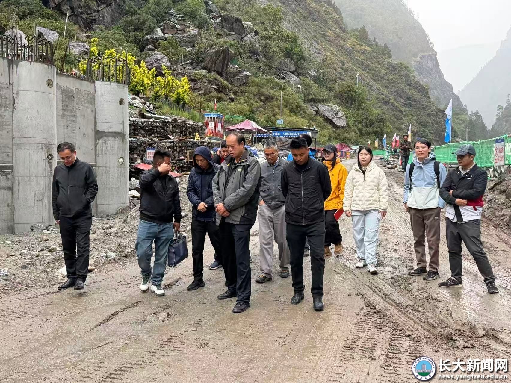
The team carried out joint research on glacial lake outburst floods in China-Nepal transboundary rivers and worked on disaster prevention and mitigation capacity building.
Zhang said officials and researchers from both countries discussed information sharing during that trip.
In mid-August, ICIMOD also invited a team from the Chengdu Institute of Mountain Hazards and Environment to Nepal for further exchanges, with the aim of advancing cooperation on glacial-lake monitoring and related areas.
For now, however, these efforts remain at an early stage.